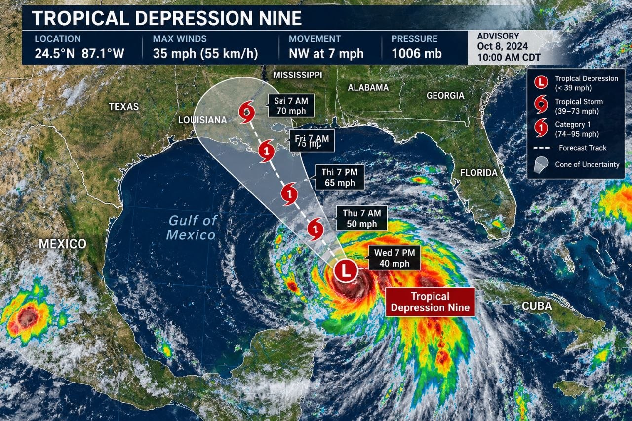
A tropical disturbance in the southern Gulf of Mexico has officially strengthened into Tropical Depression 9, according to updates from the National Hurricane Center. Forecasters predict the system will rapidly intensify, becoming Tropical Storm Isaias before ultimately developing into the first hurricane of the 2026 Atlantic hurricane season by Thursday.
Meteorologists tracking the system report that shower and thunderstorm activity around the broad area of low atmospheric pressure has become increasingly organized. While current computer forecast models indicate the storm will steer clear of Texas, the system poses potential weather threats to other parts of the U.S. Gulf Coast as it moves northward later in the week.
Forecast Track and Potential Impact
According to the latest guidance from the National Hurricane Center, Tropical Depression 9 is expected to strengthen into Tropical Storm Isaias by late Tuesday or Wednesday morning. Forecasters anticipate the system will eventually come ashore along the northern Gulf Coast, with potential landfall targets ranging from Louisiana and Mississippi eastward toward Alabama and Florida by the weekend.
While most modeling consensus suggests that Texas will avoid direct impacts from the system, regional authorities and residents along the central and eastern Gulf Coast are closely monitoring the developing weather patterns. Computer models continue to show a range of possible tracks, pointing toward potential heavy rainfall, gusty winds, and coastal storm impacts as the system organizes.
What Lies Ahead for the Gulf Coast
As the system organizes in the southern Gulf, forecasters will continue issuing regular updates regarding its trajectory, wind speeds, and potential strengthening. Emergency management officials encourage residents in low-lying areas and along the potential strike zones from Louisiana to Florida to stay informed as the system evolves into the season’s first anticipated hurricane.